flight info page(s)
AA 736 SNA-DFW
AA 1935 DFW-MCI
other google
map
toys or here
mapki
mapki
projects
everythingisnt
site seeing
satellite link maps
earth explorer
fun links
from
register
cartography link
Food
Sabatino's Italian ICBM
N 33.612712 W 117.926425 Google
Map 251 Shipyard Way , Newport Beach 92663-4437
949-723-0645
Snead's Bar-BQ
ICBM N 38.817312 W 94.58485
Google
Map 171st & Holmes, KCMO (816/331-9858)
Jack Stack Martin City ICBM N 38.882744 W 94.586266
Google
Map 135th & Holmes (Martin City), KCMO
(816/942-9141)
2337 Manchester #237 ICBM 33.7928 -117.8928 33.7926 N,
117.8925 W (Topo)
View Map to Trailer
Click
here
to see an aerial photo of 2337 Manchester
2337
Manchester
#237
topo
#95 ms
virtual
earth
625 W Katella #28 ICBM 33.8091 -117.8595 (mapquest) 33.7926 N, 117.8925
W (Topo)
View Map to Office photo
ms
virtual
earth
Click
here
to see an aerial photo of 5052 Dutcher
Yahoo
5052
5052
topo
5052 Dutcher ICBM 33.6902041N -117.778094W (Yahoo) 37.27846N -11427994E
(Topo)
5052
mapquest
map
6309
topo
6309
aerial
photo
6309
EPA
Map map photo/map
Grandview High resolution Map
(image) This image is 7500 x 7500 pixel jpg of map.
It
probably will have to be downloaded and viewed to be useful.
12733 Oakland
ICBM N 38.892578 W
94.505918 Google
Birdseye
1801 Guinotte
ICBM N 39.116327
W 94.559659 acme
birdseye
5510 E 103rd
ICBM N 38.938875 W
94.526582
birdseye
US
KTTV 69
studio ICBM N
32.597110 W 117.090236 ACME
Photo Photo2 Google
link Google earth
photo
ms
virtual
earth
Gil's
ICBM N 39.182424 W 94.487132 ACME
Photo Photo2
Larry's
ICBM N 38.91870 W 94.110350 ACME
Photo
Ed's
ICBM N 38.980052 W 94.582597 ACME
Photo Photo2
Photo-bw
ms
virtual
earth birdseye
Mill spring
Ct ICBM N 38.761848 W
90.573364
ms
virtual
earth
Rick's
house ICBM
N 38.447731 W 90.454514 ACME
Photo Photo2 google earth photo ms
virtual
earth Nasa
worldwind oblique
Eric Gerry
ICBM N 38.413497 W 90.410143
ACME Photo Photo2 google earth photo ms
virtual
earth
Bart
ICBM
N 33.956141 W 118.44689 ACME
Photo Photo2 Google
(ICBM N 33.956219 W 118.446865)
Larry
Mills
ICBM N 38.918456 W 94.105700 ACME
Photo Photo2 Google
Powell Observatory
ICBM N 38.646363 W 94.699888 ACME
Photo Photo2
web page
DSS
ICBM N 38.215949 W 94.556148 ACME
Photo Acme2 acme
Old ASKC
Obs ICBM N
38.991779 W 94.519283
bing
Richardson
El.
ICBM N 41.881239 W 88.40225 ACME
Photo
Beacon
Ave
ICBM N 38.692214 W 90.255911
ms
virtual
earth
Red
Coat
ICBM
N 38.712077 W
90.457178
ms
virtual
earth
St Charles
Airport ICBM N 38.846064 W
90.496968
ms
virtual
earth
1013
Bosse
ICBM N 37.965554 W 87.626033 ACME
Photo bing
Photo2
Google
florida
spot ICBM N
29.269818 W 82.120236 ACME
Photo
Google
John's
bldg
ICBM N 35.115045 W 82.150749 ACME
Photo bing
105 N. Main, Campobello, SC possible
bldg
Boeing
Surplus
ICBM N 47.415920 W
122.228997
bing
Kent Wa.
Intel,
Dupont ICBM N
47.11220 W 122.632620 Acme
Alumax, Goose Crk
ICBM N 33.05197 W
80.05375 Acme
Arecib
ICBM N 37.0625 W
95.677068
google
JPL
ICBM N 34.199838 W118.174119 bing
local
15416
White
ICBM N 38.84449 W 94.52080
birdseye
local
Fred
ICBM N 38.931345 W 94.595804 birdseye
603 Olive,
Rolla ICBM N 37.948411 W
91.768756 streetview1 streetview2
233 general gardner
ICBM
rosie
bing
shirley
bing
dee
bing
Windows Live
Doubletree
DC
ICBM live
live
local
Fort
Osage
ICBM
N 39.187581 W 94.19228 Google
ACME
La Area
Arium
ICBM
N 33.710357 W 117.80425 ACME
Photo Photo2
ms
virtual
earth
Norco
photo
Santa Fe
3751
ICBM N 34.019208 W 118.225636
Google
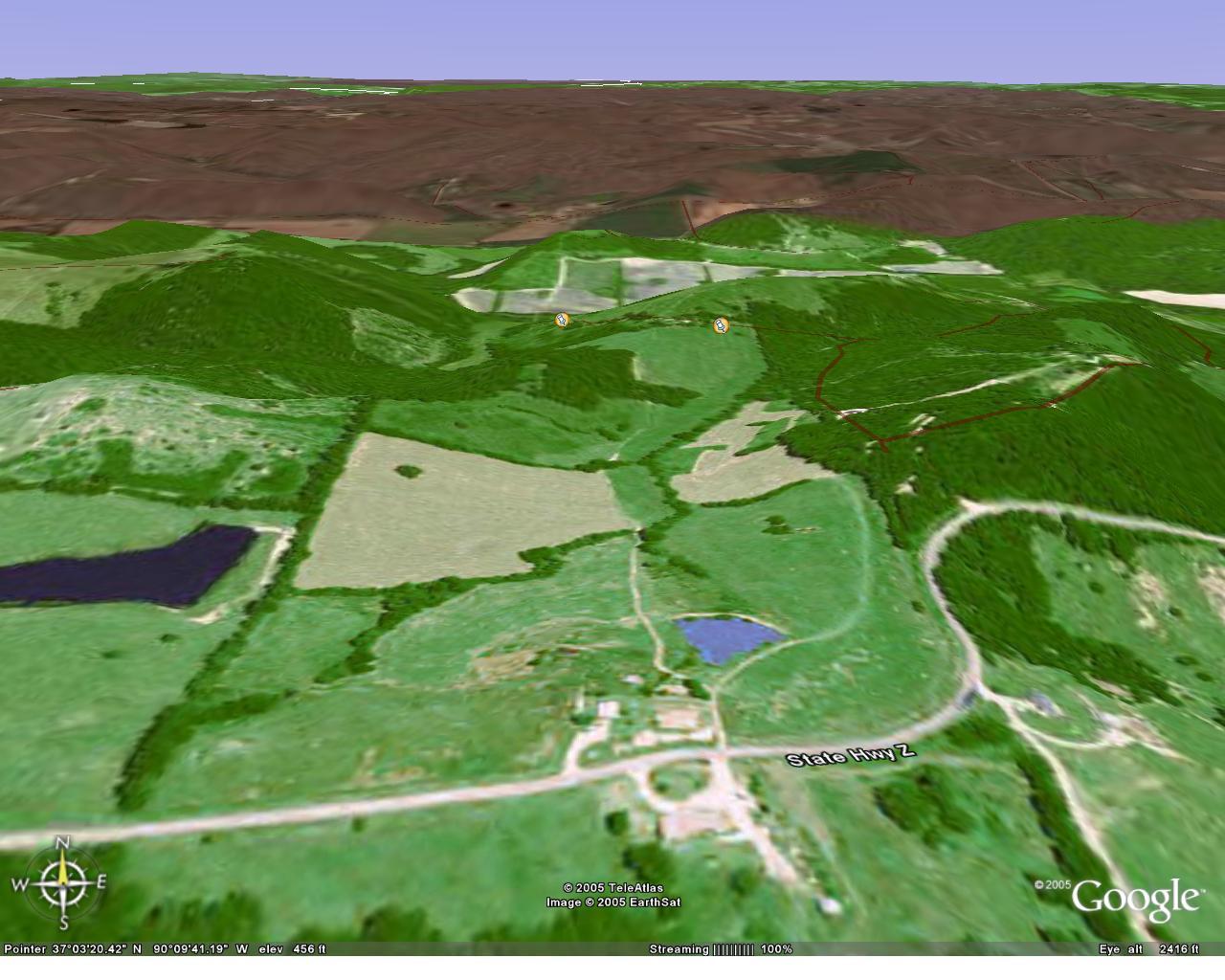
Southeast Missouri
farm
ICBM
DD:MM:SS
= N 37:3:48.3444 W 90:9:29.934
ICBM
DD:decimal = N 37.063429 W 90.158315
google
map
link
ms
virtual
earth
farm
topo
yahoo
maps
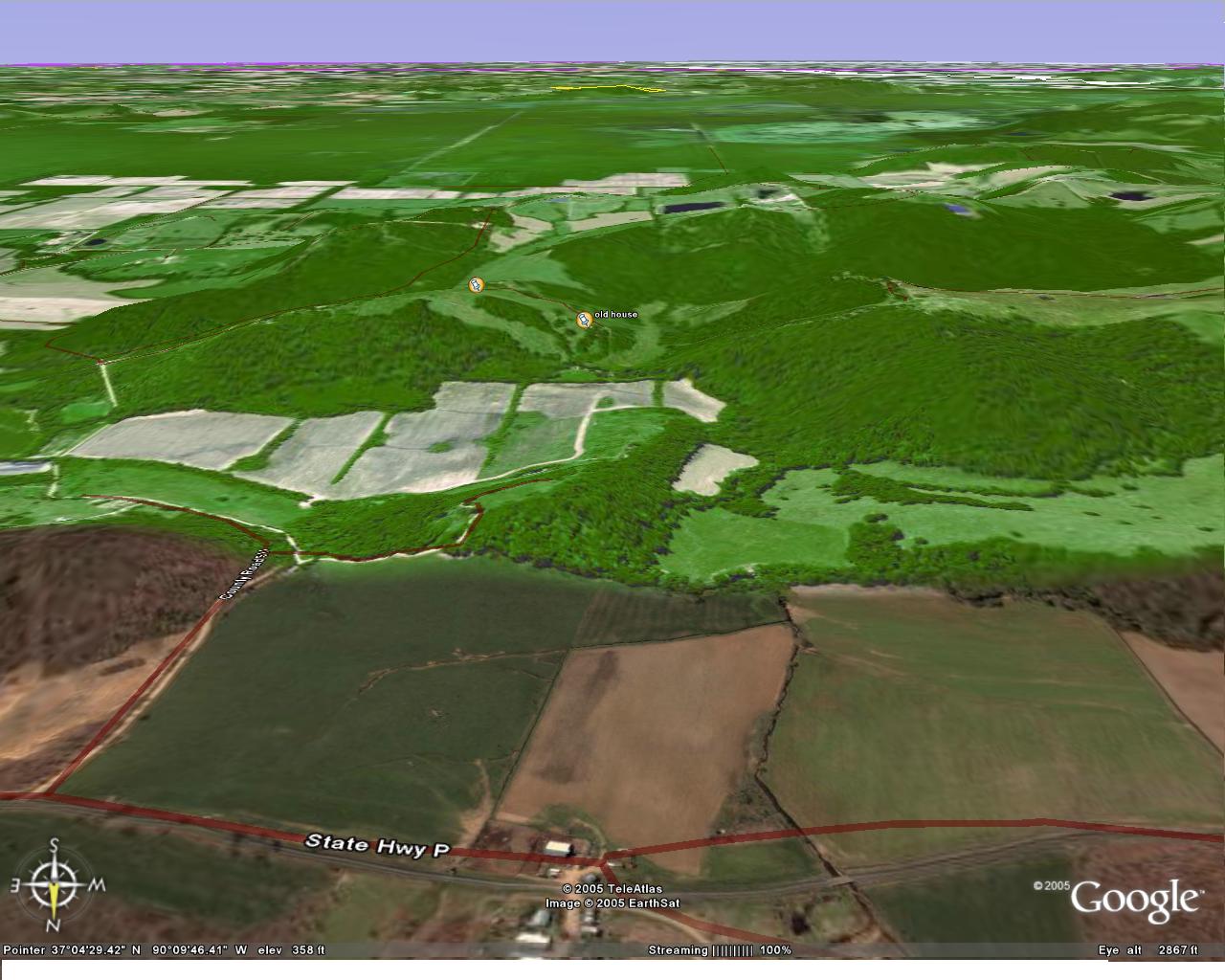
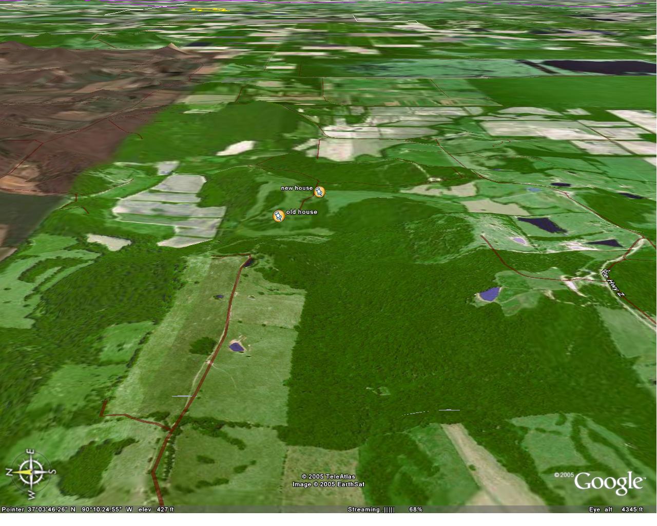
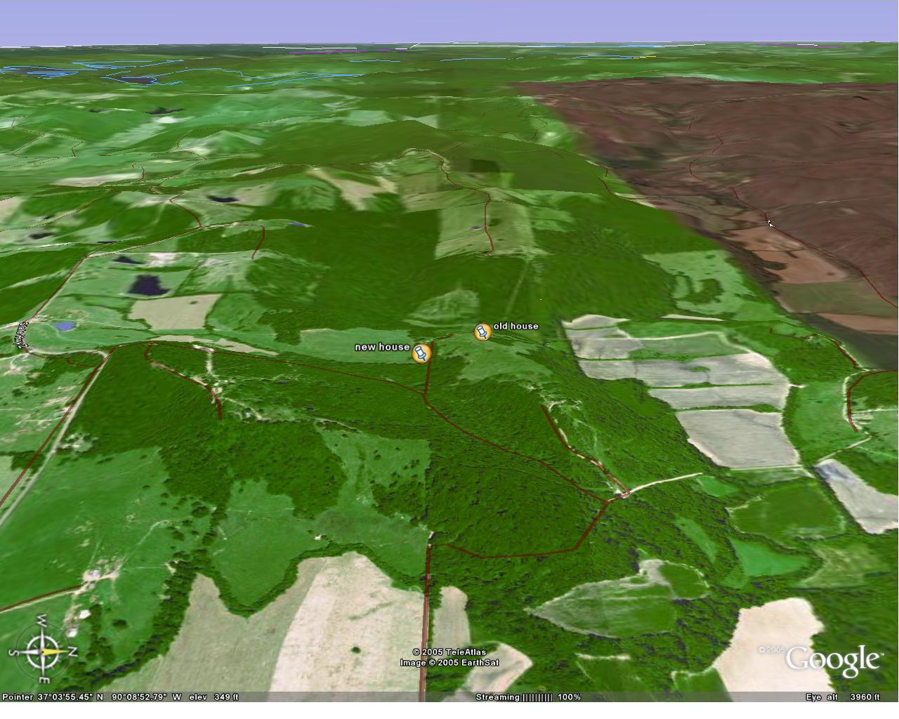
farm views: houses marked, compass rose, in lower left corner
Farm Flyaround version 2
Here are two views of the farm, showing the Stephens Cemetary, where
Grandpa,
Grandma, Uncle Fred, and Aunt Luella are buried, among others.
N/S
alligned
picture
birds eye view SW to NE view picture
Lowndes
Links based on Doyle Sharp's trip
Lowndes Church
ICBM
DD:MM:SS=37 deg 08 min 56.80 sec N Lat
90
deg 15 min 53.19 sec W Long
ICBM
DD:decimal=N 37.149085 W 90.264806
Acme
link Acme photo
Lowndes Farm (Grandpa Bell's house)
ICBM
DD:MM:SS=37
deg 09 min 54.02 sec N Lat
90
deg 13 min 47.60 sec W Long
ICBM
DD:decimal=N
37.164989 W 90.229902
Acme
link Acme
photo
Various Views around Lowndes
Grandpa Bell's house, extreme
closeup. Here is Photograph from
ground level by Doyle
Lowndes area birds eye.
This is a view with the eye just north of central lowndes, and has
farmhouse in upper left.
General view of Wayne county with
markers for Lowndes, Grandpa Bell's house, and the farm.
Lowndes general area. Higher
detail, color with both house and church
Indiana
Crisney
farm
ICBM
N 37.98867 W 87.065812 Acme
photo Acme
topo
kmz for
farm
shirley.kmz (requires google earth)
google palomar
mountain
Military Missle Web
Ring, Nike
Nike Site SF-88 Virtual
Tour
Atomic
Bomb
General Store
interesting
spot1 Google
Equivalent
interesting
spot
2 Google
equivalent
various items visible on aerial photos
Johnson Space Center
Saturn
5
ICBM N 29.552663 W 95.09479 Google
photo
Redstone
Arsenal Saturn
5
ICBM N 34.710008 W 86.654842 Google
photo
Redstone features a
real Saturn on it's side, a fake one,
standing, and an addional Apollo / LEM set.
Kennedy Space Center
Saturn
1 ICBM N
28.523796 W 80.683596 Google
photo
Kennedy Space Center
Saturn 5 ICBM N 28.605344 W
80.669646 Google
photo acme
Michoud Operations,
LA Saturn 5 ICBM N 30.023801 W
89.920276 acme
S-1C-15
first stage
would have
been
used in Skylab 2. Also
contains
original F-1's for
Apollo
15 and 16. photo from
post
hurricane
site
KSC Layout photo / map
USS Hornet,
CV-12 Alameda
ICBM N 37.771682 W 122.30272
photo Acme
Google
Google Earth
USS Iowa
BB-61 Bencia ICBM N
38.068389 W
122.10039 bing
photo
Acme
(no
bb) Google
link
USS New Jersey BB-62
Philadelphia ICBM
N 39.893503 W 75.187655 bing
photo
Acme
Google
link
USS Missouri BB-63
Pearl
Harbor ICBM N
21.362379 W 157.95347 bing
photo Acme
Topo
USS Wisconsin BB-64
Norfolk ICBM N 36.848173 W
76.295432 bing
photo Acme
(no
bb) Google
Link website
USS Arizona
BB-39
ICBM
N 21.365005 W 157.94998 bing
photo
Acme
Topo website
USS
Utah
BB-31
ICBM
N 21.368904 W 157.96253 photo
Acme
Topo
USS
Ling
ICBM
N 40.880162 W 74.039502 photo Acme website wiki
USS Albacore
Portsmouth
ICBM N 43.082297 W 70.767007
photo website
USS Nautilus New
London
ICBM N 41.386966 W 72.088324
photo website
wikipedia
-
new london
RMS Queen Mary Long Beach
Ca
ICBM N 33.75266 W 118.18817
photo Acme
Google
link website
USS
Midway San Diego,
Ca ICBM N 32.713986 W
117.175136 photo
windows
live
USS Midway Bremerton Wa
ICBM N 47.55252 W 122.65431
photo Acme
USS Pueblo Pyongyang N. Korea ICBM
N 37.0625 W
95.677068
Google
link
NAS Richmond, Florida remains of blimp hanger destroyed 15 Sep
45 article
ICBM
N 25.617595 W 80.401415 Google
maps
note column is 90' high, and is south support structure for the
east doors of the 1000' long hanger. There were three originally,
all
destroyed in a hurricane, along with significant aircraft from
the remainder of Florida Naval installations. here is google earth kmz pointer
DC9 on approach in google maps (over
St.
Charles) Here is DC9 from Globe explorer website
from
22 mar 2002 imagery, showing it is AA DC9
snapshot
of same aircraft from MS
Virtual Earth link to imagery
ICBM N 38.778951 W 90.49919
C5 + KC-135 midair Acme
Mapper
Site
O-2
Warrensburg,
Mo
ICBM
N 38.883882 W
93.546721 photo Acme
Peterson
Ranch
ICBM
N 33.6506 W
106.4603 Acme
Trinity
Crater
ICBM
N 33.677162 W 106.475665 Acme
travel info
Air Tracking
Passur
link McCarren, LAS
site list
Track flights in flytecomm
Track flights in flightaware
Tracking by airport flightaware
MCI
SNA LAX STL EVV
Tracking by aircraft type flightaware
Tracking airports + google earth fboweb
Track satellites link www.n2yo.com
sample departure track on mapper.acme.com of Delta SAN-ATL
trip by Shirley
Myth busters spots
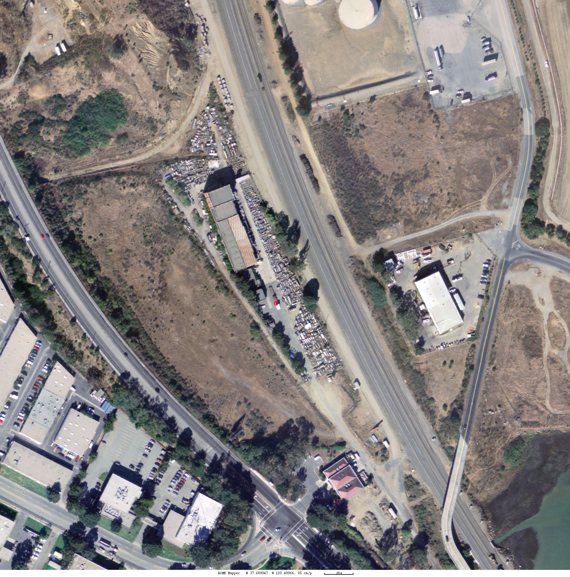
Machinery and Equipment, Co.
3401 Bayshore Blvd Brisbane,
Ca ICBM N 37.689047 W 122.40066
Map
Photo
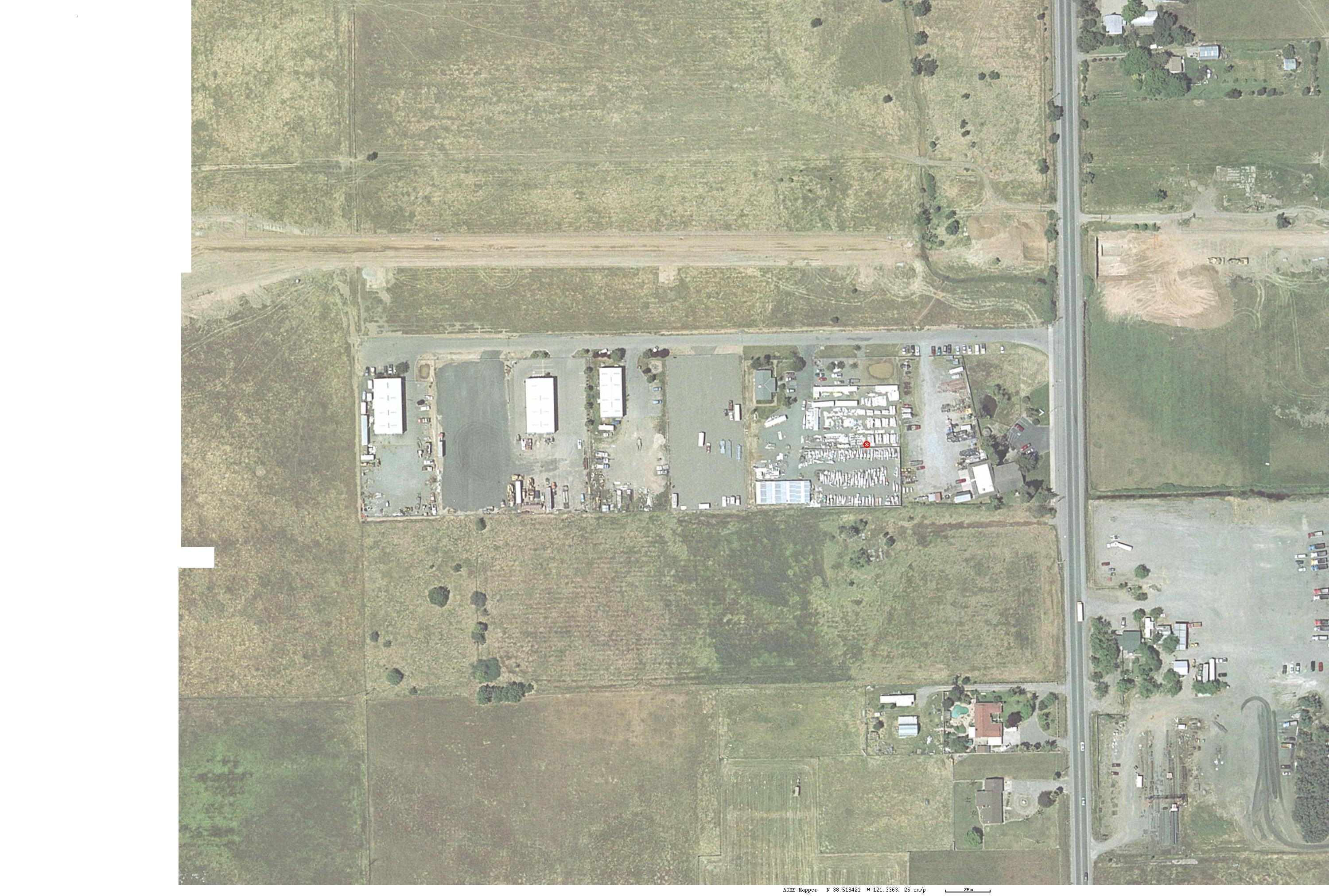
Faeth Aircraft.
5954 Bradshaw
Road Sacramento, ca ICBM N
38.518421 W 121.33630 Map
Photo
Australia
Dave Rose ICBM S
37.989200 E
145.27250
Acme
photo
mapper service (address required) services.land.vic.gov.au
Great Britain
Large Roundabout in Hemel Hampstead Google
Map ICBM N 51.746277 W 0.473316
Havant Langsdon,
Xyratex
Google Map
ICBM
N 50.84732 W 0.98947
Multimap
photo
Havant Hotel, Hayling Island
Google
Map ICBM N 50.83213 W
0.97147 Streetmap.co.uk
Abbey Road
Studios
Google
Map Multimap
Streetmap
Webcam
Local.Live
birdseye
** thanks to Billy Pettit for correcting location and to Abbey
Road Live show updates for verification **
Jodrell
Bank
ICBM
N 53.236519 N 2.308674 Google
Map Multimap
Steetmap
postal
code SK11 9DL web site
France
Google Earth clone http://www.geoportail.fr
<currently saturated by new users (6/22/06)>
Italy
all city (Tutto Citta) web site (italian)
link
Ospitalitalia
link
Ivrea
ICBM N 45.46520 E 7.88155
hotel
la
serra
Ivrea
ICBM N 45.482365 E
7.878625
hotel lago sirio
Pisa
ICBM
N 43.72299 E
10.39626 leaning
tower
view up Aosta Valley over
Lago Sirio
Google links
Arnold Mo, Lupine Drive http://maps.google.com/maps?ll=38.413525,-90.410732&spn=0.007446,0.007693&t=k&hl=en
2300 S
lewis
http://maps.google.com/maps?ll=33.792357,-117.894137&spn=0.007993,0.007821&t=k&hl=en
6309 e 148
terr
http://maps.google.com/maps?ll=38.856282,-94.521947&spn=0.007993,0.007821&t=k&hl=en
12733
Oakland
http://maps.google.com/maps?ll=38.892578,-94.505918&spn=0.007993,0.007821&t=k&hl=en
Arium
http://maps.google.com/maps?ll=33.710711,-117.804347&spn=0.007993,0.007821&t=k&hl=en
International
Pic du
Midi
quicktime vr view of
observatory other links
conference link
webcams
live
cameras
new york city transit
google
webcam
locator
Rolla
solar house pad Google
Maps Camera1
(opentopia)
Camera2
(opentopia) Campus
Map
map sites
maporama
rand mcnally
ersi (like google earth)
fast food
mapquest
map24
ancient observatories from space Space
Imaging
conversions
http://quake.geo.berkeley.edu/convert.html online conversion
USGS maps
Degree conversion decimal to dd:mm:ss
This utility will allow you to convert from
decimal degrees to
a degrees:minutes:seconds representation and back. It also
handles degrees and decimal minutes.
Please enter in the format of DD:MM:SS or DD:MM.MMM for degree
conversion. For example, 36:24:36. If any of the degree, minute, or
second unit is 0, please enter 0 as well. For example: 36:00:36.
|